WARREN COUNTY GOVERNMENT:
www.warrencountync.com
COUNTY SEAT: Warrenton
FORMED: 1779
FORMED FROM: Bute
LAND AREA: 428.46 square miles
2020 POPULATION ESTIMATE: 18,642
White: 40.5%
Black/African American: 51.4%
American Indian: 5.7%
Asian: 0.4%
Pacific Islander: <0.1%
Two or more races: 2.0%
Hispanic/Latino: 3.9% (of any race)
From State & County QuickFacts, US Census Bureau, 2020.
CONGRESSIONAL DISTRICT: 1ST
BIOGRAPHIES FOR![]()
Warren County
 WILDLIFE PROFILES FOR
Piedmont region
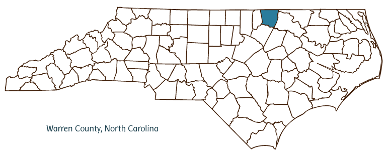
GEOGRAPHIC INFORMATION
REGION: Piedmont
RIVER BASIN: Roanoke, Tar-Pamlico, Map
NEIGHBORING COUNTIES: Franklin, Halifax, Northampton, Vance
See also: North Carolina Counties (to access links to NCpedia articles for all 100 counties)
by Peter Bangma, 2006
See also: Haliwa Indians; Saponi Indians; Soul City.
Warren County, formed in 1779 from no-longer-extant Bute County, is located along the Virginia-North Carolina line in the northeastern Piedmont. The lands that became Warren County were home to significant populations of Tuscarora, Haliwa, and Saponi Indians. Inland migration by English settlers placed these Indian groups under increasing pressure in the first decades of the eighteenth century. The modern-day Haliwa-Saponi tribe, linked to the Indian people who remained in the area, was formally recognized by the state in 1979, with Warren County as part of its home territory.
Warren County was an early center of the state's tobacco- and cotton-growing plantation economy and the birthplace of many of its early political leaders. The county seat, Warrenton, was established in the same year as the county, and both are named for Joseph Warren, revolutionary Patriot and physician killed in the Battle of Bunker Hill. The town of Macon, incorporated in 1889, was named for Nathaniel Macon (1757-1837), who called the county home and served as Speaker of the U.S. House of Representatives and as a U.S. senator. Other Warren County communities include Arcola, Elberon, Inez, Liberia, Manson, Norlina, Ridgeway, Vaughn, and Wise.
Warren County's plantations were among the most prosperous in North Carolina. The county was also home to one of the largest free black populations in antebellum North Carolina.
After the Civil War, the county's agricultural economy failed to recover, but its black landholders and a new population of freedmen made the county an important if short-lived cradle of black political clout during Reconstruction. John Hyman, the first African American to represent North Carolina in the U.S. Congress, hailed from the county. Whites and blacks in Warren County and other surrounding "Black Belt" counties endured economic misfortunes as the state's northeastern counties failed to enjoy the industrial growth seen elsewhere in the state. After World War II, the region's blacks began to find their voices, and many of them played important roles in the local and statewide movements for civil rights. One of the most prominent was Littleton native Ella Baker, a key figure in the founding of the Student Nonviolent Coordinating Committee. In the 1970s civil rights leader Floyd B. McKissick worked to build a new town in Warren County called Soul City, a community meant to foster and celebrate the aspirations of African Americans but one that failed to meet expectations.
In the early 2000s Warren County remained largely rural, with an economy primarily based in agriculture and light industry. In warm-weather months, people from North Carolina and Virginia travel in significant numbers to Kerr Lake and Lake Gaston, two man-made lakes that are partially located in the county and offer opportunities for boating, swimming, fishing, and other outdoor activities. The area has also maintained a strong commitment to preserving its historic architecture from the early nineteenth century; Warrenton's historic district is listed on the National Register of Historic Places. The estimated population of Warren County was 20,000 in 2004.
Annotated history of Warren County's formation:
For an annotated history of the county's formation, with the laws affecting the county, boundary lines and changes, and other origin information, visit these references in The Formation of the North Carolina Counties (Corbitt, 2000), available online at North Carolina Digital Collections (note, there may be additional items of interest for the county not listed here):
County formation history: https://digital.ncdcr.gov/Documents/Detail/the-formation-of-the-north-ca...
Index entry for the county: https://digital.ncdcr.gov/Documents/Detail/the-formation-of-the-north-ca...
Additional resources:
Corbitt, David Leroy. 2000. The formation of the North Carolina counties, 1663-1943. https://digital.ncdcr.gov/Documents/Detail/the-formation-of-the-north-carolina-counties-1663-1943/3692099?item=4553233 (accessed June 20, 2017).
Warren County Government: http://www.warrencountync.com/
Warren County Chamber of Commerce: https://www.warrencountync.com/480/Chamber-of-Commerce
DigitalNC, Warren County: https://www.digitalnc.org/counties/warren-county/
North Carolina Digital Collections (explore by place, time period, format): https://digital.ncdcr.gov
Image credits:
Rudersdorf, Amy. 2010. "NC County Maps." Government & Heritage Library, State Library of North Carolina.
1 January 2006 | Bangma, Peter